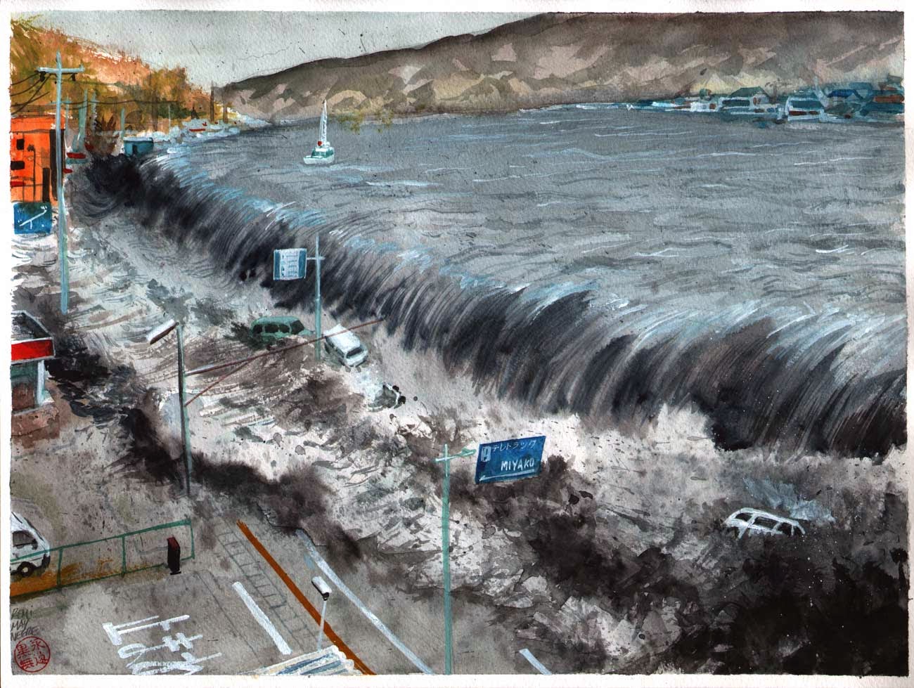
Tsunami in the Indian Ocean on December 26, 2004 is one of the biggest disasters that befall mankind throughout history. Giant waves hit the beaches in Asia - South-East and South - and East Africa almost without any warning. A total of 243 thousand lives taken away. Indonesia, Sri Lanka, Thailand, and India suffered extensive damage unprecedented.
Regardless, there is always the wisdom behind the disaster. Raise awareness of the tragedy of the tsunami. Some countries even spend on research and improvement of early warning systems.
Now, 10 years later, the network monitor seismic and tsunami buoy installation expanded to be aware of other deadly surge in Samudara the Indian, Pacific, and in the Caribbean Ocean. In fact, experts are now able to predict a tsunami will hit - a few hours before the first giant wave came.
However, there are still obstacles in order to save the lives of anyone who threatened the tsunami. For example, the lack of a warning system that will help those who need to seek protection. To stay away from the beach.
In 2004, a tsunami struck the coast of Sumatra just 9 minutes after the 9.1-magnitude quake stopped shaking.
Early Warning System
Since 2004, geologists found evidence of sand deposits dielak forced by the giant waves - triggered by an earthquake for thousands of years in a cave in Sumatra. Record the tsunami.
Although risky, previously there was no tsunami early warning system in the affected areas threatened. Now, a warning network for US $ 450 million has been in operation - which consists of 140 seismometers, about 100 meter above sea level and some buoys (buoys) that detect tsunamis - although still encounter some obstacles.
Some buoys are installed into the target of vandalism, or accidentally damaged. Though the buoy and also gauges have significance to help detect, whether an earthquake triggered a tsunami.
A global network of Deep-Ocean Assessment and Reporting of Tsunamis (DART) which detect tsunami waves have also been expanded, from 6 buoys in 2004 to 60 in 2014.
Regional tsunami warning center has also been built in Australia, India and Indonesia. Scientists there decide whether a tsunami could potentially occur based on the information from the sensor network, estimate how big the waves, and warned the government - which will be followed up by giving warnings through sirens, TV, radio, and a brief message.
Give a warning to people who live in remote areas is one that is still so new that the system constraints. Not all warnings to the local community entities. And not every tsunamigenic earthquakes can scare people. To keep them away from the beach.
In the Mentawai Islands, Sumatra, in 2010 a tsunami that killed more than 400 people. One reason, residents failed to evacuate themselves in a very short lag time - in between the earthquake and the arrival of the tsunami. Apparently the shock when it is not strong enough to make people there worry. Different from what happened in 2007 when residents busy to evacuate themselves. Thus the results of the investigation Tsunami Research Center at the University of Southern California. Also there was no clear warning that time.
From Count Hours to Minutes
Another hurdle is how to accurately estimate the tsunami wave swing. The 2004 tsunami in Aceh to a number of bounces from the beach - even in a location that is not calculated as Sri Lankan and western Australia.
Pattiaratchi then returned to Colombo, told the people not to worry. There are no upcoming waves, safe condition. "But 20 minutes later, the 7-meter waves came. Two hours later there is still another wave crashing."
A tsunami warning could be issued only 5 minutes after the earthquake under the sea makes the ocean floor up or down, triggering a tsunami. To make more detailed predictions, the scientists used data collected from seismometers, GPS stations, tide gauges and buoy system (buoy) submitted to the warning centers via satellite.
"Tsunami like dropping a stone into a pond. The ripples are ditumbulkan not uniform, mountains and valleys influenced seabed," said Eddie Bernard former director of NOAA's Pacific Marine Environmental Lab.
After the earthquake made the Earth broke down, the tsunami center NOAA scientists spent the next hour to make detailed estimates of the tsunami, including where it will bounce. The results are projecting when the waves will arrive at the coastline and ports, the current estimate and measure the resulting tsunami wave heights.
The trick is to build a better seismic network, get a way to get a faster response of sea level sensors and speed up computer estimates.


0 comments:
Post a Comment